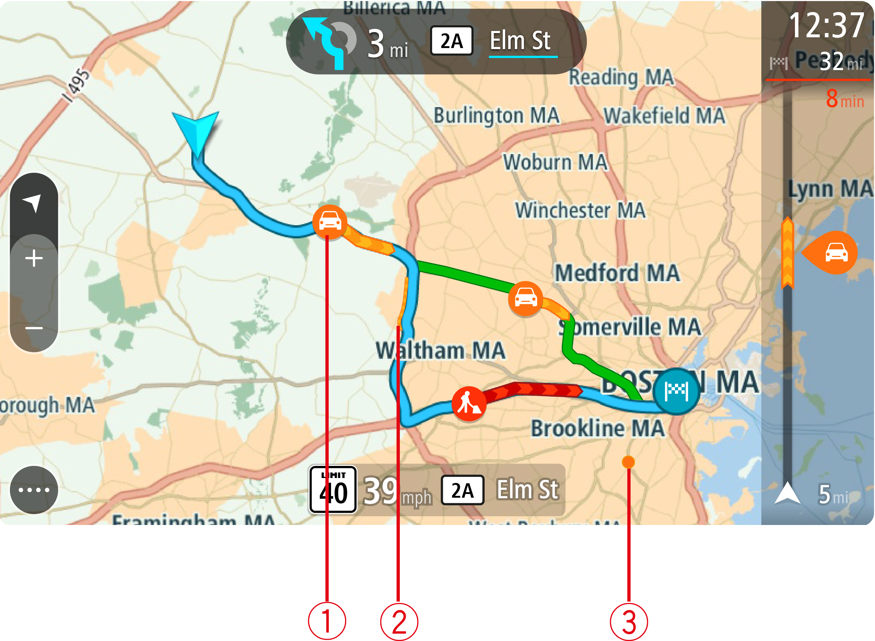
Traffic incidents are shown on the map. If several traffic incidents overlap, the highest priority incident is shown. For example, a roadblock is higher priority than road work or a closed lane.
Tip: Select an incident on the map to see more detailed information.
A symbol or number at the start of the incident shows the type of incident or the delay in minutes, for example 5 minutes.
The color of the incident indicates the speed of traffic relative to the maximum allowed speed at that location, with red being the slowest. The stripes on the traffic jam are also animated to show the speed of the traffic, where appropriate.
For a complete list of incident types, see Traffic incidents.